Crater Rim Walkway
On Sunday 03 September we decided to get out and enjoy the fine weather we have been having by going on a hike. The Port Hills, which form the northern extent of the Banks Peninsula, border Christchurch on the south side and offer many great tramping opportunites. The Crater Rim walkway generally follows the crest of the Port Hills from Coopers Knob near the head of Governor's Bay to Evans Pass near the mouth of Lyttleton Harbour (connecting trails make it possible to hike all the way to the end of Godley Head.)
To gain access to the Crater Rim walkway we ascended Dyers Pass Road through the community of Cashmere to Summit Road. At the intersection of Dyers Pass Road and Summit Road lies the Sign of the Kiwi, an historic rest house turned cafe and teahouse. This is one of several historic rest houses built in the early 1900s including the Sign of the Bellbird, the Sign of the Takahe, and the Sign of the Packhorse, all part of entrepreneur Harry Ell's vision for the completion of a Summit Road from Godley Head to Akaroa. The Sign of the Kiwi provides great views to the north overlooking Christchurch. A great place to take a break and have a spot of tea while enjoying the view.
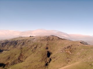
Heathcote Valley from the Bridle Path

As it turned out the Sign of the Kiwi proved extremely popular and we could not even find a parking place, so we decided to continue on towards our planned carpark near the Bridle Path. We headed east along Summit Road and paused briefly at Castle Rocks to check it out. Castle Rock is a prominent volcanic outcrop and popular local climbing area.
Castle Rock provides a great view to the north of the Heathcote Valley and the Bridle Path from Heathcote up the valley to the crest of the ridge where it intersects Summit Road and the Crater Rim walkway. The Bridle Path was hastily constructed in the winter of 1850-1851 to provide soon to be arriving settlers with a route from Lyttleton Harbour north over the Port Hills to the plains which Christchurch now occupies. The Bridle Path is steep; consequently, most luggage and freight was ferried around to the north through the estuary and up either the Avon River or Heathcote River.
Lyttleton Harbour

We parked our car at the Bridle Path carpark to begin our tramp. From the Bridle Path carpark, if you look to the south you can see much of Lyttleton Harbour. To the north you get a fine view of the Heathcote Valley northwards to the estuary. This is also the point where the Bridle Path intersects the Crater Rim walkway. There is a carpark at the start of the Bridle Path adjacent to the Gondola carpark. From the carpark at the valley floor the trail winds its way up to the head of the valley at the Summit Road. From the crest of the ridge the Bridle Path continues over the ridge and descends to the town of Lyttleton.
From the carpark at the Bridle Path along Summit Road we tramped eastward along a section of the Crater Rim walkway along the Mt. Cavendish Bluffs Track, which traverses around Mt. Cavendish and the Gondola through isolated sections of bush and shrub. The Christchurch Gondola is an aerial tramway which begins near the Gondola carpark on the floor of Heathcote Valley and ascends the northwest flank of Mt. Cavendish. At the top there is an interpretive center and cafe. We persevered against the temptation of an ice cream and a spot of tea available at the gondola cafe and continued along the track.
Gondola Building and Clouds

Soon after traversing Mt. Cavendish the bluff track meets up once more with the Summit Road and another carpark. From this point we continued westward along the Mt. Pleasant Bluff Track. The weather was fine, though a bit windy. The track wound up and down along the ridge, so at times we were exposed to the pleasantly cooling winds only to turn a corner and drop back down into a quiet, isolated section of shrub.
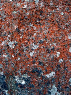
Red White and Blue

The ridge in this section of the Port Hills consists of a series of bluffs, and the trail negotiates its way along ledges between the cliffs. In some places the rocks are covered with colorful lichens, which add a bit to the scene. Not long after starting the Mt. Pleasant Bush Track we passed a lookout providing clear views to the south towards Lyttleton Harbour. We continued on for just a short while before we decided to call it a day and head back towards the carpark.
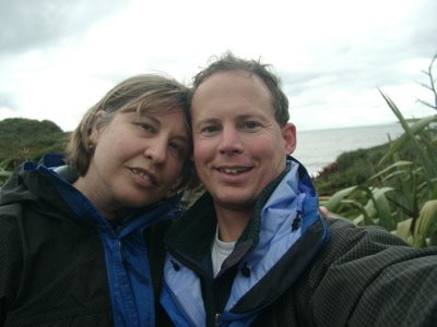
Tramping along the Crater Rim Walkway

We soon made it back to the carpark and decided to finish our short tour of the Port Hills by continuing eastward along the Summit Road and head back down the ridge via Mt. Pleasant Road. Mt. Pleasant Road slowly winds down a ridge through the community of Mt. Pleasant, finally ending at Ferry Road and back home.
There are many tracks to explore in and around the Port Hills and we look forward to exploring more tracks in the area.
To gain access to the Crater Rim walkway we ascended Dyers Pass Road through the community of Cashmere to Summit Road. At the intersection of Dyers Pass Road and Summit Road lies the Sign of the Kiwi, an historic rest house turned cafe and teahouse. This is one of several historic rest houses built in the early 1900s including the Sign of the Bellbird, the Sign of the Takahe, and the Sign of the Packhorse, all part of entrepreneur Harry Ell's vision for the completion of a Summit Road from Godley Head to Akaroa. The Sign of the Kiwi provides great views to the north overlooking Christchurch. A great place to take a break and have a spot of tea while enjoying the view.

As it turned out the Sign of the Kiwi proved extremely popular and we could not even find a parking place, so we decided to continue on towards our planned carpark near the Bridle Path. We headed east along Summit Road and paused briefly at Castle Rocks to check it out. Castle Rock is a prominent volcanic outcrop and popular local climbing area.
Castle Rock provides a great view to the north of the Heathcote Valley and the Bridle Path from Heathcote up the valley to the crest of the ridge where it intersects Summit Road and the Crater Rim walkway. The Bridle Path was hastily constructed in the winter of 1850-1851 to provide soon to be arriving settlers with a route from Lyttleton Harbour north over the Port Hills to the plains which Christchurch now occupies. The Bridle Path is steep; consequently, most luggage and freight was ferried around to the north through the estuary and up either the Avon River or Heathcote River.

We parked our car at the Bridle Path carpark to begin our tramp. From the Bridle Path carpark, if you look to the south you can see much of Lyttleton Harbour. To the north you get a fine view of the Heathcote Valley northwards to the estuary. This is also the point where the Bridle Path intersects the Crater Rim walkway. There is a carpark at the start of the Bridle Path adjacent to the Gondola carpark. From the carpark at the valley floor the trail winds its way up to the head of the valley at the Summit Road. From the crest of the ridge the Bridle Path continues over the ridge and descends to the town of Lyttleton.
From the carpark at the Bridle Path along Summit Road we tramped eastward along a section of the Crater Rim walkway along the Mt. Cavendish Bluffs Track, which traverses around Mt. Cavendish and the Gondola through isolated sections of bush and shrub. The Christchurch Gondola is an aerial tramway which begins near the Gondola carpark on the floor of Heathcote Valley and ascends the northwest flank of Mt. Cavendish. At the top there is an interpretive center and cafe. We persevered against the temptation of an ice cream and a spot of tea available at the gondola cafe and continued along the track.

Soon after traversing Mt. Cavendish the bluff track meets up once more with the Summit Road and another carpark. From this point we continued westward along the Mt. Pleasant Bluff Track. The weather was fine, though a bit windy. The track wound up and down along the ridge, so at times we were exposed to the pleasantly cooling winds only to turn a corner and drop back down into a quiet, isolated section of shrub.

The ridge in this section of the Port Hills consists of a series of bluffs, and the trail negotiates its way along ledges between the cliffs. In some places the rocks are covered with colorful lichens, which add a bit to the scene. Not long after starting the Mt. Pleasant Bush Track we passed a lookout providing clear views to the south towards Lyttleton Harbour. We continued on for just a short while before we decided to call it a day and head back towards the carpark.

We soon made it back to the carpark and decided to finish our short tour of the Port Hills by continuing eastward along the Summit Road and head back down the ridge via Mt. Pleasant Road. Mt. Pleasant Road slowly winds down a ridge through the community of Mt. Pleasant, finally ending at Ferry Road and back home.
There are many tracks to explore in and around the Port Hills and we look forward to exploring more tracks in the area.


6 Comments:
Sounds like a fun day! Beautiful pictures. Can't wait to see some of that great country!
I see you implemented the Lightbox for your pictures. I like it!
I also like the link to my my blog Kiwi Tracks, thanks!
Good mexican dinner the other night, we have to repeat that at our house some time soon.
Jo
Jo: Thanks! Your blog Kiwi Tracks is a great inspiration. I am currently using the Lightbox JS v2.0 script as it allows me to group all the images from a single post together for folks to view.
Hi I have been reading you terrific blog in prep for an all too brief trip to the south island in november. there is one question I can't seem to find an answer to. We will be renting a car, do you think we should get a four wheel drive car?
ihavelipbalm: About the car rental, that depends upon the type of off-road driving you intend. New Zealand does actually have paved roads :-). I own a 2 wheel drive car which has been sufficient for our explorations to date. Since you plan to arrive in November (Spring here), snow covered passes should not be a great concern (however, if you still have concerns regarding snow you can always rent chains).
thanks, so much, i figured as much but wanted to make sure. we are using your explorations as fodder. I can't wait to get there. your blog is at once helping me through the waiting AND making it harder
Post a Comment
<< Home