31 August 2006

Tranquil Lake Tekapo


On the weekend of 4-6 August, Gaby and I made our first trip south of Christchurch to Lake Tekapo. We met up with our friends Dave and Elizabeth for a weekend of fun exploring the area. We left Christchurch early Friday afternoon so we could see the countryside in daylight. From Christchurch we traveled south on State Highway 1. When we reached Rangitata we turned off onto State Highway 79 through Geraldine to Fairlie.

Just after turning onto State Highway 79 we passed through the small town of Geraldine, where we both just happened to spot a cheese shop, so we had to stop and see what they had :-) The cheese shop, located in the Berry Barn Complex, stalks a fresh selection of Talbot Forest Cheeses, a local artisanal cheesemaker. After perusing their unexpectedly fine selection of artisanal cheeses, we bought a wonderful blue cheese and a hard sheep's milk cheese with chives. I also bought a nice cast iron fondue set - a definite necessity.

Objects in mirror may be closer than they appear.


From Geraldine we made our way to Fairlie and the junction with State Highway 8, where we headed west over Burke's Pass and entered Mackenzie Country, named after James McKenzie (this is supposedly his actual name), an early explorer and supposed sheep wrangler. The Mackenzie Country refers to the upland area lying in the foothills of the Southern Alps and contains several mountain lakes, including Lake Tekapo. State Highway 8 winds through the Albury Range, then drops to a large plain of rolling hills with an astonishing view of the surrounding snow capped peaks.

The lakes in this area (and others around New Zealand) contain what is referred to as glacial flour, a fine particulate matter eroded from the surrounding mountains by, you guessed it - glaciers. This glacial flour defracts sunlight and causes the brilliant azure blue and turquoise colors of the lakes, adding to the already picturesque environment.

We finally arrived at our weekend bach (that's Kiwi for a weekend cottage) around 5:00 pm. Dave and Elizabeth arrived shortly thereafter, and we then decided to walk to the store and buy something to cook for dinner.

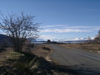
Lake Tekapo


We settled on a community cooked affair of a great Indian vegetable curry with fresh broccoli, kumara (Kiwi for yam), cauliflower, etc, along with a wonderful rice. To accent this savory meal we bought a good Tripel, a locally produced specialty beer from Monteith's - it's quite nice.

That evening we settled in for a relaxing evening by the fire and decided what we wanted to do for Saturday. We were told of a good ski resort called Ohau, within about an hour of Tekapo and we decided to check it out. Gaby opted out of skiing because her shoulder was still bothering her, so she decided to take a short hike around Tekapo and visit some of the famous sights along the shoreline.
Bringing in the Sheaves - I mean, Sheep


Saturday morning Gaby took advantage of the opportunity of a warm quiet morning to sleep in to her heart's content before setting out to see the sights. A church, the Church of The Good Shepherd, was built on the shoreline in 1935. I suppose part of what makes this building so popular is its setting amongst such beautiful mountains. Lake Tekapo lies along a major route to Mt. Cook and during the height of the tourist season bus loads of folks flock to the church along the shores of the lake. It may also help that there are restroom facilities nearby :-)

Church of the Good Shepherd


Not far from the Church of the Good Shepherd is a statue of a collie dog. The bronze sculpture stands as a tribute to all the working collie dogs of the area.

Tribute to Working Collie Dogs


The Tribute:


"This monument was erected by the Runkolders of the Mackenzie County and those who also appreciate the value of the collie dog, without the help of which the grazing of this mountain country would be impossible."


On Saturday I joined Dave and Elizabeth on a trip to the ski resort Ohau. I had only been on skis once before and was keen to get some instruction on the basics. We headed off towards the skifield, winding through the hills and valleys, always heading towards the precipitous snow capped peaks. It is very evident this area was carved by glaciers, as most of the mountains rise from the valley floors at a heart stopping incline. This was where things got fun. Being from Southern California, I am used to wide, paved roads leading to expansive parking lots. The roads to ski fields are a wee bit different here in New Zealand. Keep in mind that it's currently winter here, with ice and snow on many of the roads, and we were driving in a two wheel drive car.

The ski fields are at the top of the tall rugged peaks and the only access is via narrow single lane dirt roads carved into the mountainside - with no guardrails! Just the drive to the parking area was exhilarating. I suppose that during storms no one can access these resorts. I was glad for our fine weather.
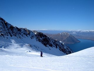
A Natural Mountain High, Ohau


Dave and I rented skis and headed off for our basic ski training session while Elizabeth headed for the slopes for a bit of intermediate instruction. Ohau has a neat conveyer belt system called "The Magic Carpet" which you can ski onto for a ride to the top of the bunny slope - Cool! Our instructor was friendly and knowledgeable and taught us the basics of maneuvering around on skis with the snow plow technique. I had a blast on the bunny slope practicing turns and stopping. I am definitely excited about skiing - what a blast!

We left Ohau around 3:00 pm and headed back to Lake Tekapo to meet up again with Gaby. After cleaning up we all ventured over to a local tavern for a couple of pizzas.

On Sunday we all slept in and enjoyed a lazy breakfast before deciding on what to do next. We all wanted to get out and hike a bit so we decided to walk from Lake Tekapo to the top of Mt. John, just above Lake Tekapo, where the University of Canterbury has built an observatory. Lake Tekapo boasts that it has the darkest sky in all of New Zealand, and is also one of the darkest skies in the world. After seeing so many stars come out at night I don't doubt it. An outfit called Earth and Sky organizes guided tours of the facility.

Mt. Dobson from Mt John


The area around Lake Tekapo is full of tracks (Kiwi for hiking trails). This particular track zig zagged up the steep face of Mt. John, but was definitely worth the effort (you can drive to the top of Mt. John if you want to.) The summit of Mt. John gave us a great view of Lake Tekapo and its namesake town. You also get a wonderful panoramic view of the surrounding snow capped peaks.

University of Canterbury's Mt. John Observatory


After a brief but necessary stop to eat some potato chips we headed back down the trail towards Lake Tekapo. The air was crisp but the scenery was great.

Lake Tekapo from Mt. John Observatory


We enjoyed our first trip south of Christchurch and look forward to exploring a bit farther south in the near future.
Bookmark and Share

28 August 2006

Playing in Punakaiki


Over the weekend of the 28-30 July Gaby and I decided to get out of town once again. We again traveled along State Highway 73 west from Christchurch, over Arthur's Pass, to Greymouth. We then turned onto State Highway 6 and headed north out of Greymouth for our weekend destination - Punakaiki. The West Coast of the South Island is chock full of interesting and beautiful places, and Punakaiki pulls its weight in both departments.

A few months ago a group of friendly folks gathered together to explore a few of the caves and other sites along the West Coast. That trip was such a success that another trip to the nearby area of Punakaiki was organized. We were informed there were several backpackers available for us to use as our home base, and several people mentioned they had stayed at the Punakaiki Beach Hostel. What sold us on this particular backpackers was the fairly accurate description that it was "only a stone's throw" from the Punakaiki Tavern, one of the better restaurants in town :-)

The Punakaiki Beach Hostel is also only a "stone's throw" from the beach, especially after a particularly harsh set of storms battered the area last year and promptly removed 30 meters of beach!

Punakaiki Beach Hostel


Gaby and I left Christchurch early on Friday so we could see Arthur's Pass during the day and arrive in Punakaiki in time for dinner. As it turns out, the Punakaiki Tavern offers some great food. When I traveled through this area last month I stopped here for a healthy dinner of fish & chips. Let me tell you, this place really knows how to cook fish & chips! The lusciously battered fish was delicately fried to a mouthwatering crispness and the chips (that's Kiwi for French fries) were perfect: crisp on the outside and soft on the inside. After a long hard day of bushwhacking I was definitely up to the task of cleaning my plate.

It was with thoughts of wonderful food that we arrived at the backpacker early enough to register for our room and unload our gear - I was hungry! For dinner I convinced Gaby that we should eat at the Tavern (she agreed: she was hungry too). We both decided to order the big, juicy stake with extra savory rosemary & garlic butter - outstanding!

With a full stomach I was able to clear my thoughts and concentrate on the task at hand - visiting with friends we haven't seen for a while and determining what we were going to do this weekend. I had to put Gaby on the disabled list as she had injured her shoulder on a previous trip (as it turns out, she injured her shoulder on our previous trip to this area.). One of my goals for this weekend was to follow up on a lead for a cave in the area we explored on a previous trip. Unfortunately, with Gaby's shoulder hurting she didn't feel up to whacking through the bush for hours on end looking for new caves, so she decided she would go for a great day hike on one of the many tracks around Punakaiki while I went exploring with a determined group of cavers.

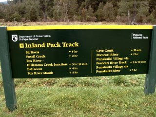
Pick a Pack Track


I gave the camera to Gaby to take with her on her hike while I bashed through the bush. She was driven to the carpark (that's Kiwi for trailhead) at the end of Bullock Creek Road where she decided to hike a loop trail back to Punakaiki. She hiked east along Bullock Creek until she met up with the Inland Pack Track, then turned south and hiked to the Pororari River, crossed it, and back out to the coast and Punakaiki.

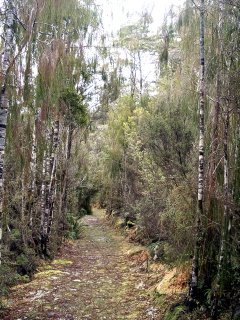
The Path of Least Resistance


This area of the West Coast has a few karst areas, and while the tracks (that's Kiwi for a hiking trail) are maintained, the bush is dense. Trampers (that's Kiwi for hikers) who wander off trail without paying attention run the risk of falling into one of the many grikes (solution cracks) in the limestone - ouch!

Sage Advice


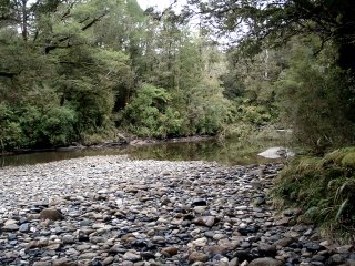
The trail was fairly straightforward, and Gaby was easily able to hike the entire route. And while the Pororari can be a challenge to cross when the water is high, she found the river to be low and was able to ford it without incident.

The Ford


note: if you don't see a car in this image, that's because there isn't one: a ford is a river crossing :-)

Crystal Clarity, a Rarity


Pretty Pororari Gorge


Lower Pororari Gorge


When Gaby finished her hike she walked along the beach near our backpackers.

Punakaiki Coastline


The coastline is scenic all around Punakaiki, even near our backpackers.

The Beach, Punakaiki


While Gaby enjoyed the loop track around to the Inland Pack Track and back, I headed off to finish exploring an area I visited on a past trip. This time we even managed to collect a few more accomplices. We geared up early and made a mad dash for our goal because we wanted to get there early enough to explore it. Forty five minutes later we arrived and began rigging the entrance drop into the cave.

Unfortunately, this cave did not go. While there are many holes and fissures in the rocks, few go anywhere. So, after satifsfying ourselves that this cave probably didn't go, we ventured through the bush again, looking in any potential dark holes. After a few hours of fruitless bushwhacking we gave up the hunt to head back to the car before nightfall. Such is the life of a ridgewalker: hours and hours of bushwhacking in the hope that one day something interesting will be found. Oh well. There will be other days.

I worked up an appetite bushwhacking all day and after I returned to the backpackers and cleaned up, I eagerly awaited Gaby's return so we could go eat dinner. We decided to head back to the Punakaiki Tavern to eat more of their great food. This time I ordered three fish sticks and a bowl of chips - that was a lot of food. It was heavenly. The fish was hot and delicate and the crisp chips really hit the spot. I had to work to eat it all, but it was such great food!

On Sunday we slept in :-)

Te Miko


When it was finally time to pack up and check out, Gaby suggested we hike down the Truman Track, as I had not seen it the day before. A forecasted storm hit that morning, but the wind and driving rain only added to the scenery of Te Miko. The tide was rising but still low enough to allow us to hike along the beach for a bit and see what this part of the coast looked like.

Just a short distance north along State Highway 6 is the Truman Track. This easy and beautiful fifteen minute walk takes you from the carpark along State Highway 6 through native bush with several nikkau palms and cabbage trees to a picturesque beach called Te Miko.

Sea Cave, Te Miko


The dark clouds and isolated blocks of rock along the beach made for some dramatic scenery. The beach at Te Miko is dramatic. At low tide you can walk along the sandy beach amongst big blocks of sandstone that have been broken off and scattered around by the waves. You need to keep an eye on the tides though. At high tide you get stuck, which is alright if you planned it that way.

Serpentine Swash Marks


By this time the storm was raging, and we stopped at Pancake Rocks to see if the ocean swells were big enough to make the blowhole spout. Through a driving rain and blasting wind we worked our way along the trail to the beach. Unfortunately, the situation was not quite rite for the blowhole. The tide has to be near high tide and the swells need to come out of the west or west south west for it to blow. Next time.
Bookmark and Share

03 August 2006

Mainline Steam


On Saturday, July 22, Gaby and I traveled by rail west from Christchurch along part of the Tranzalpine route to Arthur's Pass. For a few select weekends the train along this route is pulled by a restored steam engine. I read quite a few reviews of how beautiful this particular route is, as it winds its way west through the Rakaia Gorge, and thought the match of great scenery and a nostalgic steam engine were too good to pass up.

I like steam engines. Even from a distance they evoke a connection to a different time period. Not to mention they are very cool: a maze of pipes and valves, a great calliope of sight and sound. They are a marvel of engineering. In New Zealand, as in many parts of the world, steam engines are from a bygone era, replaced by more efficient and powerful diesel electric locomotives.

When New Zealand switched from steam to diesel electric, a group of dedicated souls fought to retain one of the steam engines and press it into service along the Transalpine route. The Transalpine route crosses the country from Christchurch on the east coast to Greymouth on the west coast. Mainline Steam operates day excursions between Christchurch and Arthur's Pass, near the midpoint of the Transalpine route.

From our previous trip along the Transcoastal route, I knew these trains were equipped with an observation car, open to the outside, where passengers could get great, unobstructed views of the passing countryside. I looked forward to seeing the sights along a different section of rail, and knew the steam engine would add a different element to the scene.

Waiting for departure, Christchurch


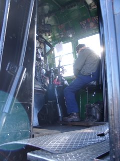
Of course, steam engines are powered by... steam! Fuel for early steam engines in New Zealand was provided by coal, found in abundance along the West Coast of the South Island. The boilers have since been converted to oil burners, but the end result is the same: the water heats up enough to boil - creating steam - which is captured and stored in pressure tanks, piped through a myriad of valves into large pistons attached to the drive wheels.

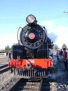
Steam engines (and, I suppose, other types of engines as well) are given a description based upon the number and position of their axles. JB 1236 is referred to as a 4-8-2. Simply stated, the engine has two axles in the front of the engine which are not driven, 4 axles which are driven - the large steam piston is attached to the wheels on the axles to provide "go" power, and finally, these four driven axles are followed by two additional non powered axles. Everything seems to have its own related language. You learn something new everyday :-)

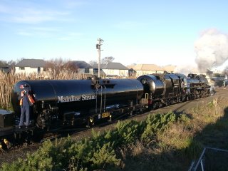
It was a cold and clear morning (the day before we experienced a particularly nasty sou'easter in Christchurch), and we saw the mushroom cloud puffs of steam from the engine as it was moved out of the railyard. Everyone gathered at the end of the station and mustered for a chance to capture an image of the steam engine connecting to the passenger railcars.

JB 1236 with water tender


This engine was built in 1939 (J 1236) in the UK and transported to New Zealand the following year. After many years of service a concerted restoration effort was begun in 1998. During the restoration the boiler was converted from a coal burner to an oil burner, and the engine was reclassified as JB 1236.

No Smoking


Steam engines require water and must periodically refill the water tenders. JB1236 is no different, and makes a stop at Springfield to replenish the water supply. I had visions of the train stopping under a large elevated wooden tank equipped with a long metal spout hinged at the bottom, lowered down to hang just above the water tender while someone pulled a cord to turn on the valve and gravity feed the water into the tank.

Stop for service, Springfield


I took this opportunity to get off the train and take a closer look at the steam engine. My nostalgic visions were destroyed when I watched the steam engine uncouple from the train and cruise down the track. I grabbed my camera and followed.

Valves and Dials


Instead of an elevated water tank, the engine moved down the track and stopped on a bridge over a small river. One of the crew then lowered a hose into the river, started a petrol powered water pump, and proceeded to fill the water tender - so much for my nostalgic vision.

Filling the water tender, Springfield


I was able to walk around the engine as the crew worked to fill the water tender. Occasionally bursts of steam would shoot out at odd angles from various places on the engine.

Drive lines


JB 1236


Christchurch is located on the Canterbury Plain, a large coastal plain along the central East Coast of the South Island, a deposit resulting from the intense erosion of the Southern Alps. This area is the bread basket of the South Island - agriculture is prevalent here. Springfield is located at the western extent of the Canterbury Plain, at the base of the Southern Alps.

West from Springfield the rail follows the couse of the Waimakariri River upstream for quite a way. Soon the terrain steepens, and the views are outstanding.

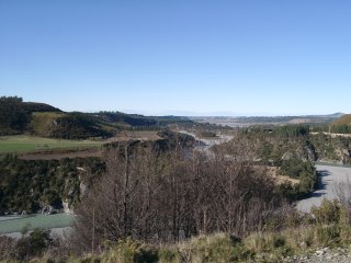
Lower Rakaia Gorge


The Southern Alps are steep and the views are spectacular. I grabbed my camera and headed for the observation car, hoping to capture some great pictures. As the railroad grade steepens, the steam engine has to work harder to pull the train along the track. When the engine works harder, more billowing clouds of steam are created. Oh, I forgot to mention the tunnels. The tracks go through many tunnels. There are something like 16 tunnels between Springfield and Arthur's Pass.

Gaby and I happily peered out over the side of the observation cars, gazing out at the scenery. I wanted to get a shot of the train rounding a corner, so I could see the whole train and the engine belching out steam. Very cool. We passed through the first tunnel. It was neat to be within 25 cm from the walls of the tunnel as we sped our way through. The tunnel was short and we quickly emerged back into daylight. The tunnels are also separated by viaducts (that's Kiwi for a bridge :-). It was fun to cross the viaducts and enter yet another tunnel, feeling the wind in your face.

Chugging up to Arthur's Pass


After a few tunnels something finally dawned on me. There is, of course, steam which blasts out of the stack of the engine - this I was fully aware of. What I did not realize however (but something that would have occurred to most average thinking people), is that exhaust (originally soot from burning coal, but now soot and unburned oil) exits the stack along with the steam. This was all well and good and quite attractive when the train was viewed around bends in the track, wending its way through the narrow gorges. However, standing in the open observation car whilst the steam engine pulled the train through the long narrow tunnels was altogether different.

The first short tunnel was not a problem. When the train passed through longer tunnels, the belching exhaust from the engine's stack filled the entire free space withing the tunnel, which inevitably engulfed the open air observation car near the back of the train. At times the oily exhaust was so thick I could not see Gaby standing 1 meter away! We both tried in vain to cover our mouths and breath through our scarves. After the fourth or fifth tunnel we gave up. We made a quick exit back to our seats. That was when we noticed the funny looks.

As we made our way back to our seats people would look at us in an odd way or even snicker. The thick clouds of oily exhaust coated everything in a thin layer of black oily soot - our hair, our clothes, and our faces were coated in it - yuck! After a quick trip to the bathroom I resolved to keep inside the train for the rest of the trip.

We made great progress up the pass, at least while the engine was holding sufficient steam pressure. The old engine had a difficult time keeping a good head of steam and on three different occasions the train had to stop to allow the boiler to "blow up" (generate enough steam pressure to continue up the pass. However, these pauses were a great excuse to get a good look at the surroundings. We eventually made it into the Arthur's Pass station (albeit, 1.5 hours later than scheduled).

The day before our trip a nasty storm rolled over the South Island, dumping 25 cm of fresh snow in Arthur's Pass. The snow was beautiful, even if it was cold. Our original plan was to spend an hour or so relaxing in a restaurant before the train's scheduled departure back to Christchurch; however, since the train arrived 1.5 hours late, we only had 50 minutes before the train was scheduled to depart. We decided to quickly get out of the station and head to a cafe for a quick bite to eat and a hot chocolate.

One of my goals during this trip was to find some keas. Kea are mountain parrots. These are large beautiful birds and very curious animals. I do not usually associate keas and snow. These birds really like attention, and often perform crazy antics so people notice them!

Curious Kea


The recent snow entirely covered the tracks in the rail yard, and after we ate lunch, Gaby and I walked back to the station to watch the steam engine head to the round-a-bout for the return trip. It was exciting to watch the engine plow the snow from the tracks as it maneuvered around to the front of the train.

Railway Station, Arthur's Pass


JB 1236, Arthur's Pass


Bookmark and Share