The first weekend of June is a three day weekend, a celebration in honor of the Queen 's birthday (no, New Zealand is not a monarchy, this is a celebration in honor of the Queen of England). Every year for many years now the
Canterbury Caving Group has been the driving force behind a weekend of caving on the West Coast of the South Island around
Charleston. This would be our first opportunity to go caving with our own gear!
We had hoped to have our new car by the time we left, but that was not the case, so we rented a car for the drive over
Arthur's Pass to the
wet - I mean West - Coast. This would be a rather posh weekend, our accommodations being a Motor Park on the edge of town, with a pub just around the corner. We had our own room with a shared kitchen and bathroom.
We left early Saturday morning to give us a chance to make some stops along the way. I have not been through
Arthur's Pass so we wanted to see it during daylight, rather than leaving late Friday evening. In the pass we stopped at a coffee shop for some well deserved hot chocolate, hoping to catch a glimpse of a
kea or two. Unfortunately, the
keas decided not to show, probably due to the approaching
fowl - I mean foul - weather. Just after leaving the visitor center in
Arthur's Pass the sky became grey and ominous. The weather had decided not to follow the weather forecast. It then rained almost non-stop until the next morning.
Out of
Arthur's Pass we hit the West Coast at the town of
Greymouth, stopped for lunch, and continued north along the coast to
Punakaiki and the nearby
Pancake Rocks, a picturesque eroded limestone formation along the coast and part of
Paparoa National Park. We braved the approaching storm for a chance to see the awesome blowhole there. Unfortunately we missed high tide by about an hour and the prevailing weather conditions were not conducive to big blowhole action, so we contented ourselves with hiking around the very cool track which winds along the seacliffs and over arches and seastacks in the making.
Just a wee bit north of
Punakaiki is the small town of
Charleston, a relic of a once large gold mining town which boomed in the 1860s when placer gold was found in the area. After unloading our baggage into our cottage, Gaby and I hiked the short distance to
Constant Bay, an extremely small, hazardous bay which was once used by ships for an anchorage, although now much of the bay has been silted in from the mining activities.
When we walked back to the house we were met by
Alice Shanks who pressed us into making a quick trip into
Metro, a cave located not far from our motor lodge. Gaby and I kitted up and practically ran to the entrance, ran around the cave for about half an hour, took a few pictures and ran back out to the motor lodge just in time for a dinner celebration at the pub. A local West Coast caver was being honored with an honorary life membership to the
New Zealand Speleological Society. It sounded like a good enough reason to end the day at a pub.
On Sunday, after sleeping in for as long as possible (lately, until about 6:00 am for me), Gaby and I took a hike back out to
Constant Bay so I could take some photos of the area before the rain came again. We cruised around the cliffs and then headed back to the motor lodge to sign up for a cave trip.
We joined up with
Lindsay Main who expressed an interest in finishing a survey in a little visited cave called
Kohatu. This would be a fun cave, as it included just a tad of vertical - a sloping entrance of 20m followed by a 10 m pitch into a rift - cool! We kitted up and off we went. This part of the West Coast has great masses of thick bush; but, as luck would have it, the trail to this cave was fairly easy going, following a small streambed for most of the time, giving us somewhat of a track to follow. At the entrance we waited as Lindsay rigged the pitch, and were promptly dumped on by a short but intense downpour. This gave us incentive to be inside the cave. Unfortunately, the rain did make for a bit of a wet pitch. Once down the pitch we entered a chamber with a small river running along the bottom, but we crossed the room on a sporting rock bridge over the chasm 10m below and followed a rift. The rift closed down to a crawl, forcing us to slither through the layer of mud and muck which conveniently lined the bottom of the passage. I will take mud anyday over hard, pointy rocks bashing against my knees and shins! This passage continued for some 200m or so before entering another chamber which meets the river once again. A quick climb down a slope put us into the stream which we followed for another 30 meters until it sumped out. Unfortunately, we were unable to figure out where the last survey stopped, or where the other passage we were to survey began, so after exploring the stream passage for a while we headed back out of the cave. What a fun cave: a little vertical work, some mud crawling, a good size cave stream and big rooms.
On Monday we decided to take it easy and join a group of folks tramping around some of the old goldfields just outside of town. When placer gold was discovered in the area, miners utilized the local streams for large monitors and sluices. The trail we followed ran along an old water race which was often dug through the low ridges for greater access. The neatest part of this trail was finding some old tunnels which had been eroded over time by the streams, some in excess of 5 meters! They looked like canyons one might see in the mud caves of Anza Borrego in Southern California; but, if you looked at the ceiling you could see the pick marks from the original hand dug tunnel - very cool!
After our hike we returned to pack up and head back over
Arthur's Pass to
Christchurch. I wanted to get a pretty early start over the pass because I did not have chains and the weather was turning cold, with icy roads a real threat. However, we made it home without a glitch!
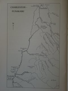
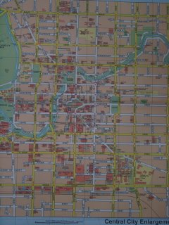
Charleston is between Greymouth and Westport on the West Coast of the South Island. Detail of the West Coast of the South Island between Greymouth and Westport.
 Looking North along the West Coast, somewhere north of Greymouth. This is the Tasman Sea.
 Yes, that bad weather is heading this way.
 Gaby and Nikau Palm.
 There are faces in the cliffs.
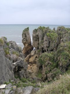 Gaby and flax.
 A large surge pool.
 Looking south from Pancake Rocks.
 Pancake Rocks detail
 Rugged coastline
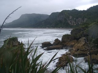 The trail cuts through the thick bush.
 I just had to take a picture of this sign. Yes, that is a penguin.
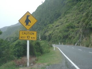 The entrance to Metro.
 Cave pretties
 Big passage
There were sections of passage with a white mineral coating on the walls.
 Group shot.
 Much of the floor of the cave was simply packed mud.
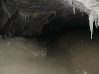 Great formation out of a fracture in the ceiling.
 All in a row.
 Attempting an artistic shot.
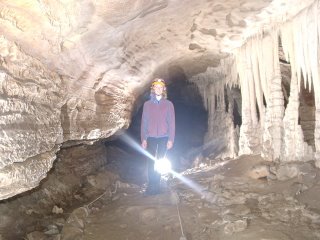 Constant Bay in foul weather.
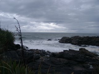 Two masted schooners used to pass through to anchor in the bay!
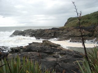
 Constant Bay and flax.
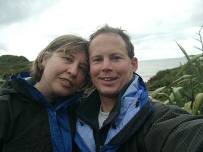
 Steven and Gaby self portrait.
 The bush extends right to the sea.
 Charleston
 Constant Bay, now silted in a bit. I have seen pictures of two-masted schooners anchored here.
 Entrance pitch of Kohatu Cave.
 View from bottom of 10m pitch.
 Gaby overtaken by a cave nebula. Look what it did to her cave suit!
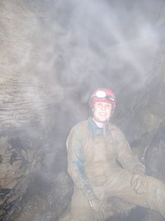 Exploring the trail along the water race through the goldfields.
 The trail passed through several hand dug tunnels.
 Believe it or not, there is a trail here.
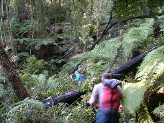 This started out as a hand dug tunnel for the water race, and the water has eroded the bottom to create tantalizing stream passage through the ridge.
 A quarter moon illuminates the snow capped peaks in Arthur's Pass.

)
)
)
)
)
)
)
)
)
)
)
)
)
)
)
)
)
)
)
)
)
)
)
)
)
)
)
)
)
)
)
)
)
)
)
)
)
)
)
)
)
)
)
)
)
)
)
)
)
)
)
)
)
)
)
)
)
)
)
)
)
)
)
)
)
)
)
)
)
)
)
)
)
)